|
|
Run 1957 |
||
|
Hares |
37°57'51.8"N 23°47'26.4"E |
||
Photos & web page: Mad Dog
The
Trail |


Main trail. Some runners continued up from the view point for a while and returned the same way.

The
Run and Walk |

The runners - from Left to Right:
Rim Job, Frosty Nuts, Absolut, visitor Sebastian, Beat The Meat

The runners - from Left to Right:
Beat The Meat, visitor Sebastian, Rim Job, Frosty Nuts, Mad Dog


Runners Rim Job and Frosty Nuts
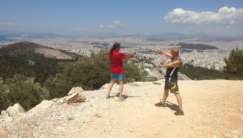
Rim Job and Mad Dog indicate points of interest in the city of Athens below

Scroll right to view all of the photo >>>>>

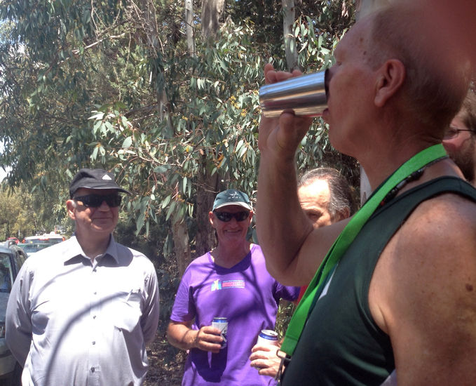
The walkers arrive. From Left to Right:
Doggy Style, Kiki, Fair Cop and Coke Dealer

Walkers Doggy Style, Kiki, and Coke Dealer
The
Circle |

A small spot in the shade of an eucalyptus tree

Hare Absolut prepares the down-downs

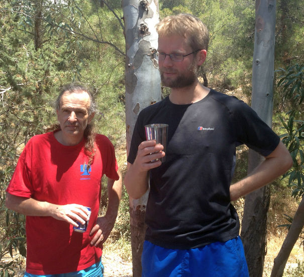
The hares ...Absolut and ...

...her brother Beat The Meat

RA Fair Cop gives the hares their traditional down-down

Mad Dog

Oxymoron
Canadian Sebastian visiting from Oxford, UK & staying in Athens for a month


Group of 5 down-down


Beat The Meat receives his 50-run badge and mug

Oxymoron gets his 250-run badge
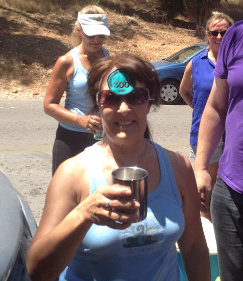
Doggy Style receives her 300-run badge


Hash Cash Wet Dream's self-awarded down-down


Rim Job

Frosty Nuts
The
Taverna |
Some hashers went to a local taverna for lunch.
ΠΡΙΝ ΤΟ ΧΑΡΑΜΑ
The directions to the hash - for the record |
…PENULTIMATE [NEARLY LAST] H@SH RUN BEFORE THE SUMMER BREAK…
Sunday 5th June - 11am
Hare: Beat the Meat
Venue: Kessariani [Imittos]
On Inn: tba
Directions to the start:
From centre:
Find yourself at the junction between Mesoghion avenue and Katechaki avenue. Set your odometer to zero.
Turn in the direction that takes you towards the mountain (and Attiki Odos). You are now in Katechaki avenue. Proceed. You will soon see large road signs that lead to Attiki Odos (green signs) and large blue signs.
Follow the blue signs. The road bends to the right and you see road signs that reads ‘Kessariani’. Follow these. They take you to the first exit to the principal road, on your right. Take this exit to the right. The distance from start to this exit is 3.4 km.
After 200 meters down this side road, turn left, going under the bridge (Alimou-Katechaki highway). Set your odometer to zero, again.
As you enter the road leading up to Ymittos, there appears to be a ‘no entry’ sign. Ignore this, as it only applies when the Mount is shut overnight.
Continue along the road that climbs up into the mountain, for 100 meters.
From North:
From the Attiki Odos get on the Ymittos ring road.
Keep going to the very end. Do not take the exit for Katechaki, but follow the sign for Kareas Ave.
Very soon you will turn off to the right (signposted to Kessariani). Turn off on this slip road right and almost immediately turn left. You will now pass under the Alimou-Katechaki highway. Set your odometer to zero here. As you enter the road leading up to Ymittos, there appears to be a ‘no entry’-sign. Ignore this, as it only applies when the Mount is shut overnight.
Continue along the road that climbs up into the mountain, for 100 meters.
Coming from the South (e.g. Voula, Glyfada)
Get on the Alimou-Katechaki highway, going towards Messoghion Avenue. Note you cannot turn off to Kessariani direct. So pass the turning on your right for Kareas. Pass the next turning on your left for Vyronas. Pass the next junction, with traffic lights. Get in the left hand lane (while still on Katechaki). At the next traffic lights there is a turning left signposted to Kessariani Monastery. Turn left off Katechaki here. You will come to a T-junction, with a cemetery on your right. Turn right here. This road goes uphill and takes you under the Alimou-Katechaki highway. Set your odometer to zero here. As you enter the road leading up to Ymittos, there appears to be a ‘no entry’- sign. Ignore this, as it only applies when the Mount is shut overnight.
Continue along the road that climbs up into the mountain, for 100 meters.
GPS: 37°57'51.8"N 23°47'26.4"E
The Taverna
After the walk, we will eat at the tavern Prin to Charama ‘ΠΡΙΝ ΤΟ ΧΑΡΑΜΑ’ at Ethnikis Antistaseos 220. 210 7231717 – 6945844019. This a continuation of the road leading down from the mountain & towards central Athens. After crossing the mini roundabout & passing a sports complex, the taverna is about 200m+ further on the left just after a Bosch sign.
Google map for the taverna:
https://mapsengine.google.com/map/edit?mid=zY9BvqjXnDFA.kjpiUjT06hkk
Dropped pin near Kesariani, Greece
https://goo.gl/maps/ApEoxDs7EoG2
Lost? Directionally challenged?? Just plain gormless and stupid???
Call the hare: 6944 219676