Mount Pendeli
(Northern Athens)

Run 1629 (Sunday 8th March 2009)

Hare: Whip It

Photographer: Mad Dog

NOTE: Use the horizontal scroll bar (bottom of screen) to view the panoramic photos.


- T H E     T R A I L -

The starting point & circle (P):
Latitude 38 04' 17.61'' North
Longitude 23 55' 21.61'' East
Altitude: 604 metres above sea level

Trail cartographic Length = 7.5 km (approx. 10 Km with falsies included)

The trail is the blue line. Roads are in yellow.


- T H E     R U N -


Panoramic image - with a view of Mount Immitos


Hashers returning from a false trail
(a certain amount of cursing was to be heard)


On On!


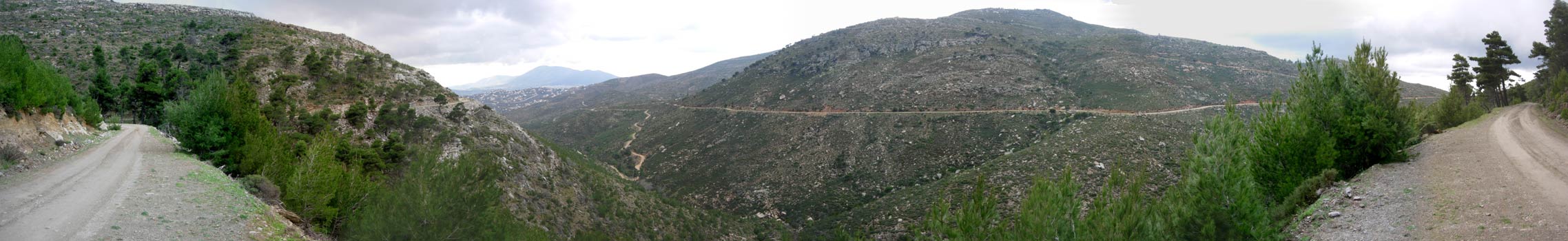
Panoramic image - showing the fine scenery


Panoramic image - with a view of the sea (and hashers on the right-hand end)


Panoramic image - with a view of rain pouring down over Drafi (a planned & excluse suburb)


NOTES

To save a photo to your disk drive:
- Internet Explorer - Netscape Navigator - Opera -

(1) Right-click your mouse on the photo
(2) A menu appears
(3) Click on "Save Picture As"
(or "Save Image")
(4) Pull-down the "Save In" menu (click the down-arrow)
(5) Double-click on a disk drive letter (to choose a drive)
(6) Double click on a directory icon (if applicable)
(7) Type in a File name of your choice for the picture
(8) Click Save

To send the photo by e-mail as an attachment:
- Outlook Express -


(1) Click the "Create Mail" button to start a new e-mail
(2) Click Insert > File Attachment
(3) Pull-down the "Look In" menu (click the down arrow)
(4) Double-click on a disk drive letter (to choose the drive)
(5) Double click on a directory icon (if applicable)
(6) Click on the photo file name to highlight it
(7) Click "Attach" to attach the photo to the e-mail

                                                                        MD Feb. 2006


Return  to Top

Please use your "Back" Button (Top Left) to return to the previous page